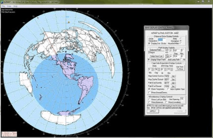
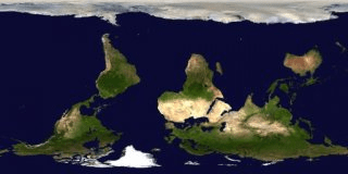
AZMap is a freeware Windows program which will generate, and display an Azimuthal-Equidistance map of the world, centered on any point on the surface of the earth (except very near the poles). The A-E map is also known as a Great Circle map since straight lines from the center point to any other point always fall along a great circle path and represent the shortest distance between the center and that point. A-E maps look fairly normal within the hemisphere of the center point, but become highly distorted in the other hemisphere (the outer part of the map). Due to this distortion, it is necessary to shut off the map drawing very near to the antipode of the center point.
A-E maps are useful for short-wave operators with directional antennas, since they can tell which territory of the earth is being targeted by the antenna. A map is first generated by entering a latitude and longitude for the center point, or selecting it from a convenient list of locations around the world. That list is contained in an ASCII text file (atlas1.txt), and new locations may be easily added by the user. The map is drawn from a geographic database and AZMap is shipped with two databases, one large with great detail and the other condensed for quicker drawing on slow computers. I recommend using the large database if possible, since it has fewer errors and contains many newly formed countries that are not in the condensed database. Ocean areas may be optionally colored to differentiate them from landmass. To the right of the A-E map is a Control Panel dialog which interacts in real time with the map to produce effects and optionally add any of the following optional overlay elements:
- short and long path from the center to a specified endpoint.
- range circles with specified spacing (constant distance from the center.
- sunlit/darkness shading with flexible interactive time adjustment
- latitude/longitude grid display with specified spacing.
- display of location identifier tags using a separate location atlas
- display of NCDXC beacon location tags.
- display of fixed auroral rings


Comments (1)